FWC-NbS 2: Complejo de humedales naturales (Type A+C)
Localización: Amyntaio, Grecia
Clima: Mediterráneo típico (verano cálido)
Superficie: 960 Ha
Objetivos: Mejorar la calidad y el almacenamiento del agua del humedal natural y su sistema de distribución.
Retos: Sequía estacional; descenso del nivel de las aguas subterráneas; eutrofización; crecimiento excesivo de juncos; contaminación del agua y escorrentías; entarquinamiento.
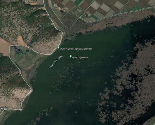
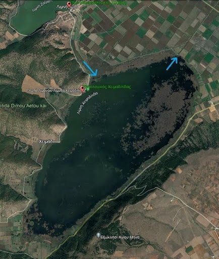
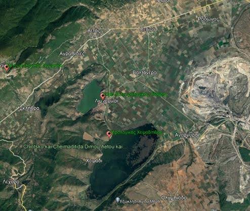
Descripción: El lago Chimaditida es un lago poco profundo que, junto con los lagos Zazari, Petron y Vegoritida, forma un complejo lacustre conectado. Está rodeado por dos pequeñas colinas y una amplia zona de cultivo creada por extensas obras de drenaje. En las zonas de encuentro con los campos se forman grandes humedales estacionales. La flora y la fauna de la zona son muy ricas: es la zona de cría más importante de Aythya nyroca, una especie en peligro de extinción, y constituye un hábitat importante para aves y especies raras de flora. El lago tiene carácter eutrófico y, dependiendo de los factores hidrológicos, climáticos y biológicos, puede oscilar entre el carácter mesotrófico y el hipertrófico. Pertenece a la red Natura 2000 de la UE; ZEPA; ZEC. Se han construido canales de conexión entre los lagos y un dique periférico para proteger los terrenos agrícolas.

Riparian buffers will be implemented in part of the lake to cope with the pressure the lake is under due to agricultural activities (irrigation, pesticide run-off, etc.). The lake can vary from mesotrophic to hypertrophic depending on the phase of the water cycle.
In the study area, there are and operate two collective irrigation networks (shown in Black and Green on the Map) that draw water from Lake Zazari, directly opposite Lake Chimaditida, and the consumption of this water has a particular impact on the water balance of the Lake Chimaditida. While almost the entire area on either side of the drainage ditch is irrigated by water withdrawals from the farmers. The integrated management of the irrigation of this area will help to reduce consumption.

In order to monitor the effect of the natural systems on Lake Chimaditita, physicochemical parameters should be observed and measured. There should be a full assessment of the quality characteristics of the lake by mapping them to reference points. And correlation both with each other and with their automatic measurement station.


This project has received funding from the European Union’s PRIMA Research and innovation programme under Grant Agreement No 2221.